
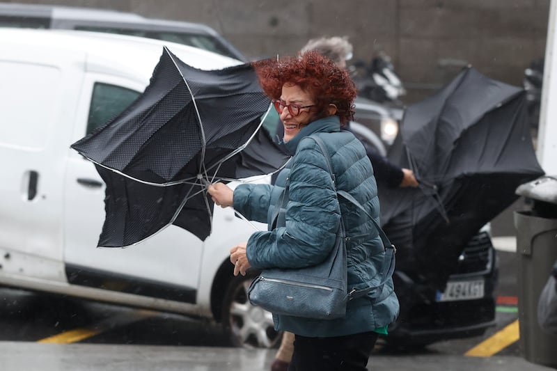
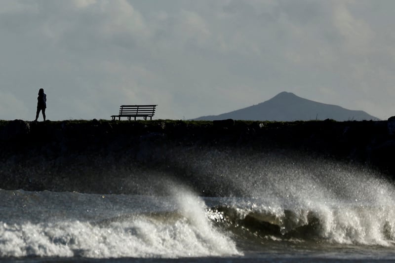
The arrival of Storm Ciaran on the UK coast on Wednesday evening could bring some of the highest wind speeds seen in England, France and countries across Western Europe in decades.
The storm arrived on the south-western tip of England with heavy rain on Wednesday evening, with the UK's Met Office warning people to take care.
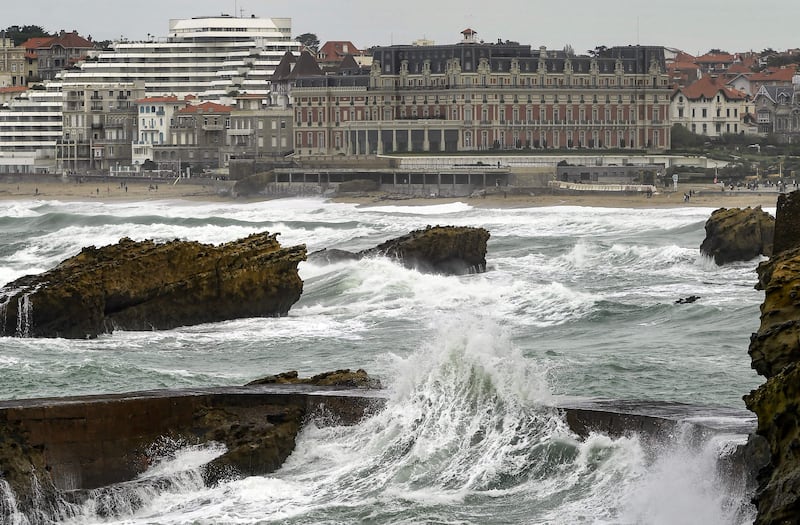
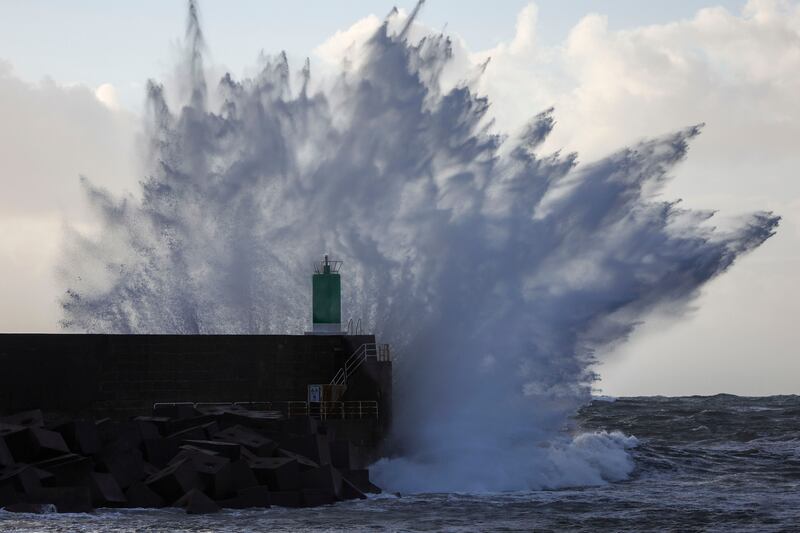
Meteo-France warned winds could reach about 145kph across Brittany, Normandy and Pays de la Loire.
Winds of up to 170kph and waves of almost 10 metres are expected in the country's north-western tip.
The national train authority, the SNCF, cancelled some regional trains in five eastern regions starting late on Wednesday night. Fast trains from Paris were eliminating intermediary stops en route to Rennes and several other destinations.
“It’s during the calmest moments that we must prepare,” Eric Brocardi, spokesman for France's National Federation of Firefighters, said on BFM-TV.
He advised residents to stay home, tightly close shutters and equip themselves with emergency kits packed with necessary medication and flashlights in case of electricity failures.
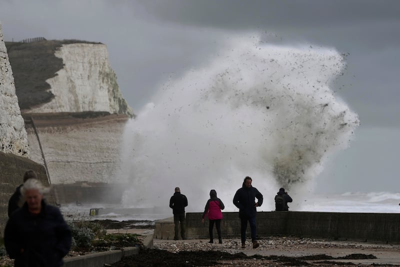
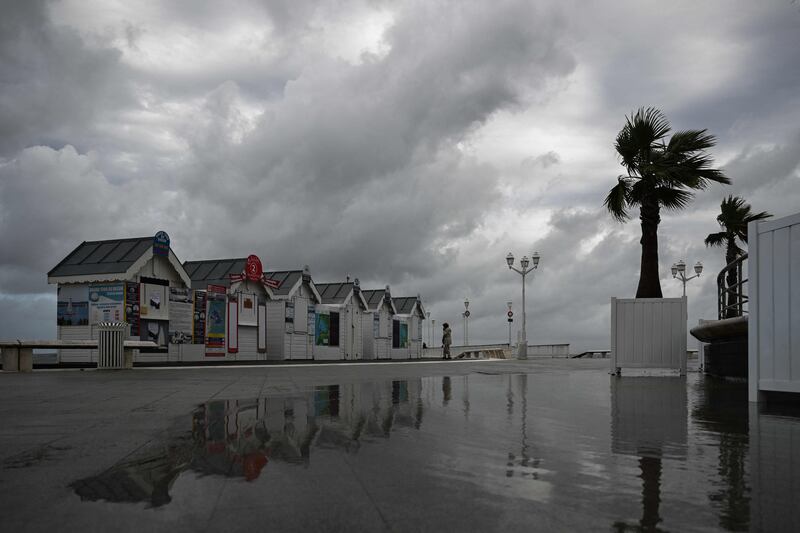
The Brittany and Normandy regions on the English Channel are expected to be the hardest hit, along with the Loire-Atlantique region to the south.
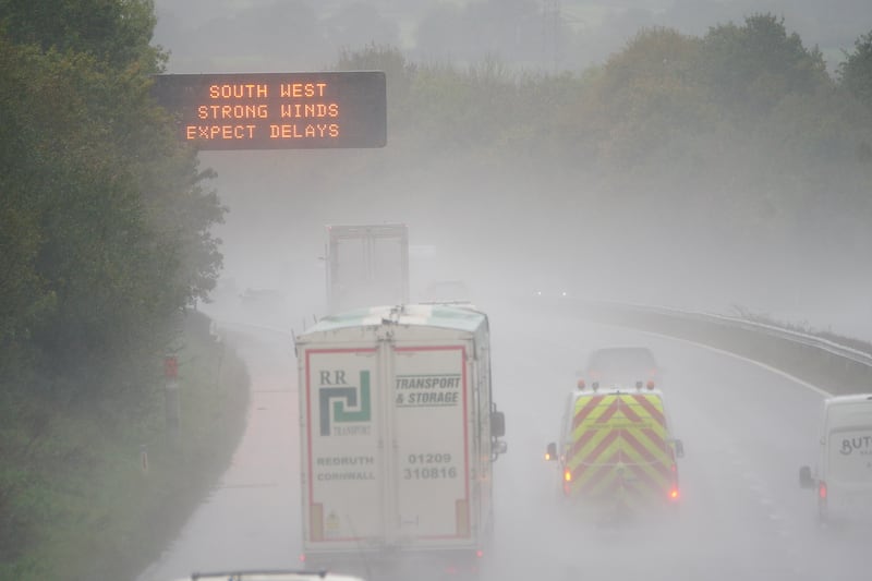
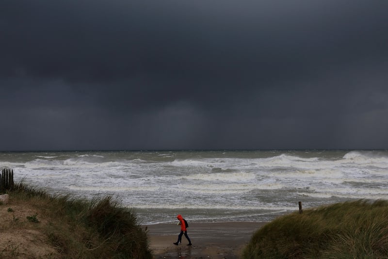
The UK's Met Office issued severe weather warnings for winds of about 130kph or more in coastal areas on Wednesday night and through Thursday.
The Channel Islands and the east of England are set to bear the brunt of the wind and rain, although much of the south and south-east will also be pummelled by heavier-than-normal wind and rain.
In q social media post announcing the arrival of the storm, the Met Office wrote: “Although there is still some uncertainty in the exact track, the strongest winds will be to the south.”
It added that “the greatest impacts [are] likely along the south coast”.
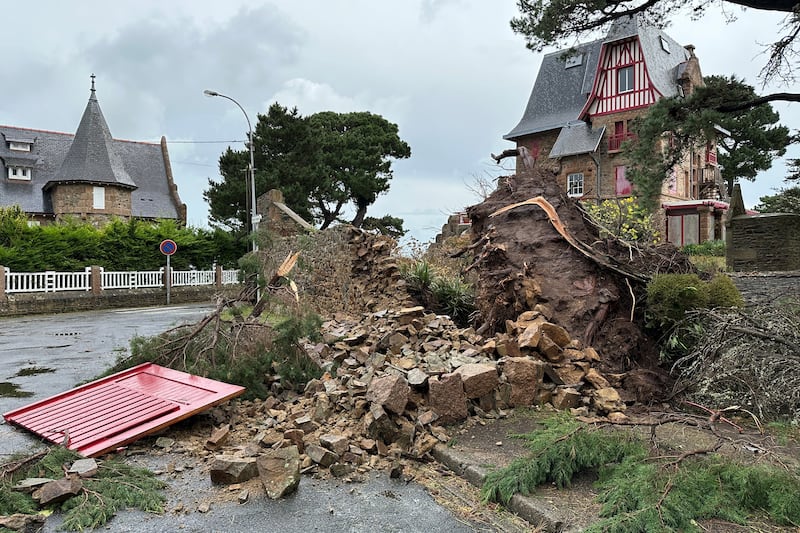
“Blowing debris is possible, you could see damage to trees, maybe tiles off roofs and damage to buildings,” said Rachel Ayers, a senior meteorologist at the Met Office, in an interview.
The last comparable high winds to hit the UK were during Storm Eunice in February last year, but Ms Ayers said this storm could cause more damage.
“Trees are in leaf at the moment, so they are more top heavy,” she said.
“That does increase the risk of them falling over and also with the leaves around that makes [for] increased drainage issues.”
Channel Islands residents have been asked not to stockpile goods after supermarket shelves were emptied there ahead of the storm. Sandbags were being handed out in several areas of England and Northern Ireland.
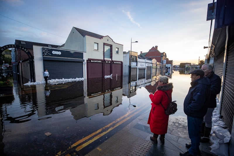
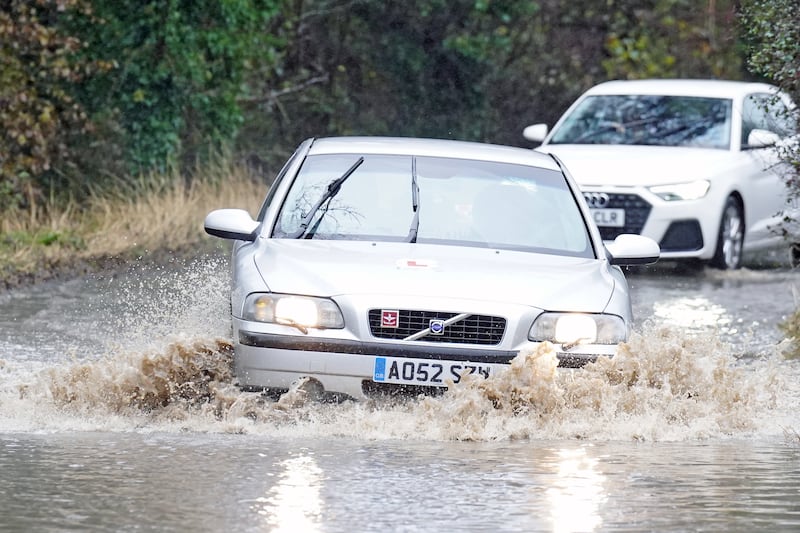
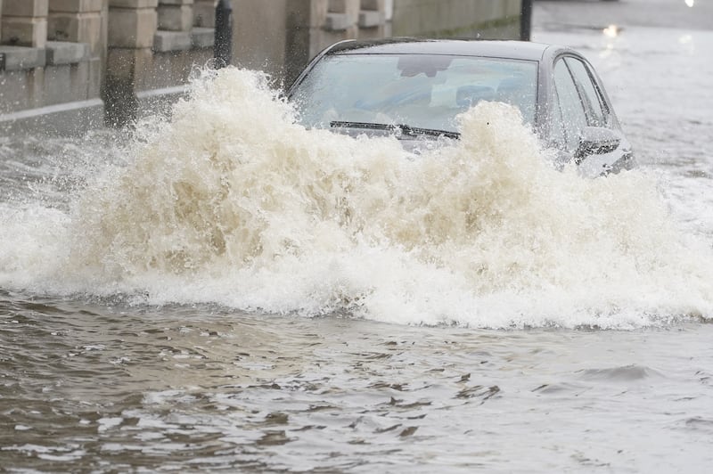
The English Environment Agency urged people to prepare for “possible significant inland flooding” on Wednesday, but the worst coastal impacts were not expected until Thursday. Wind was the biggest threat, the agency said.
Flood barriers were being set up in the south-west and the River Severn, which empties into the estuary separating England and Wales.
The unusually low pressure is expected to bring heavy rain to much broader swathes of Britain, with 80mm expected to fall in parts of Wales and the south-west on already saturated ground because of Storm Babet two weeks ago.
Heavy rain is expected to be the biggest threat to Wales and a campsite in the south-west that was already flooded will soon be at dangerous levels, the Met Office said.
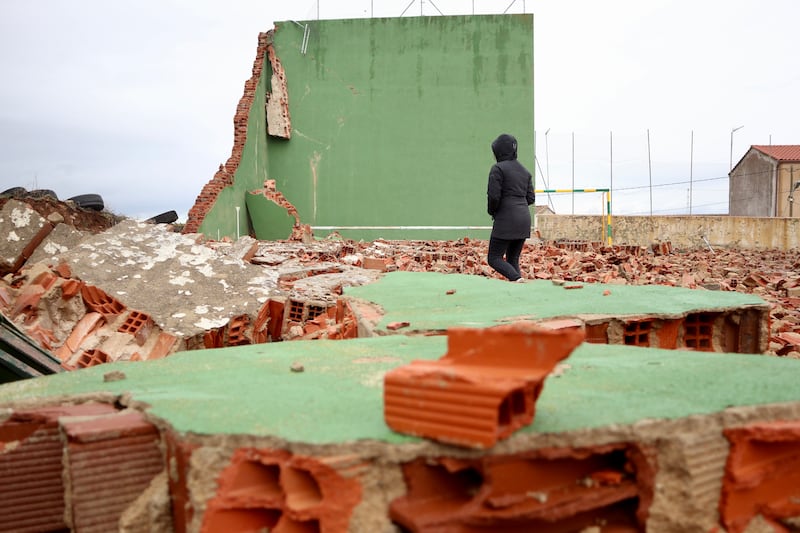
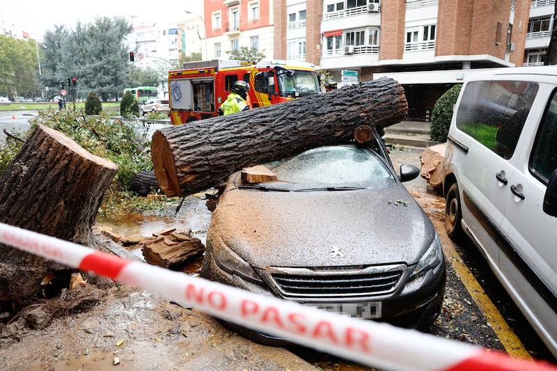
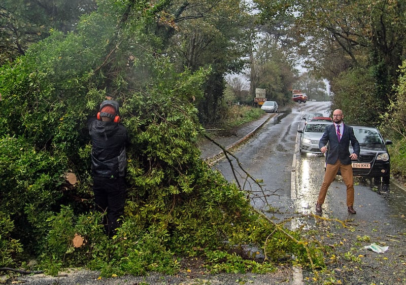
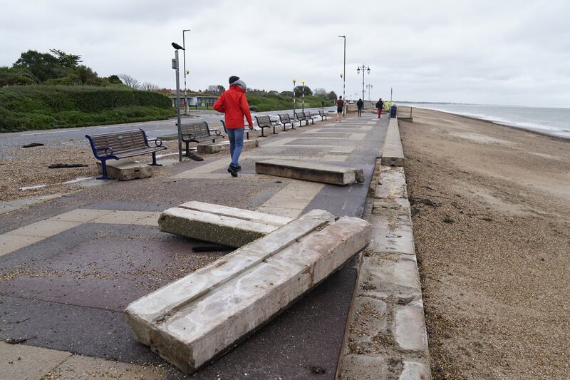
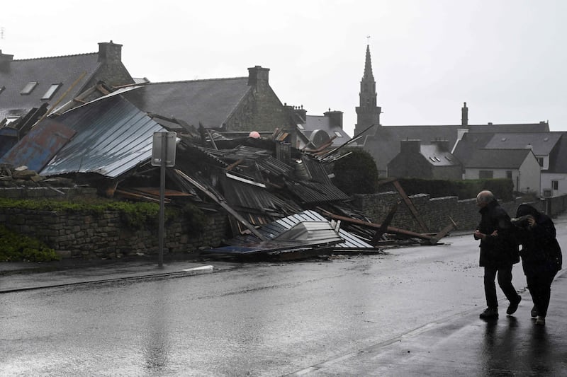
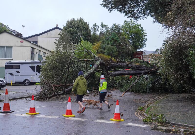
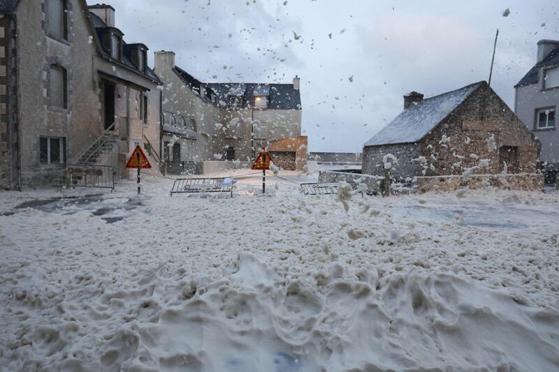
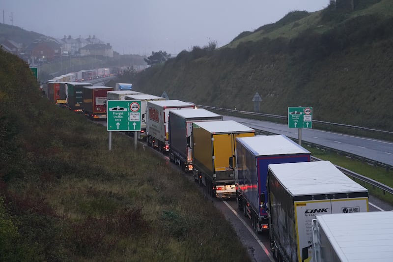
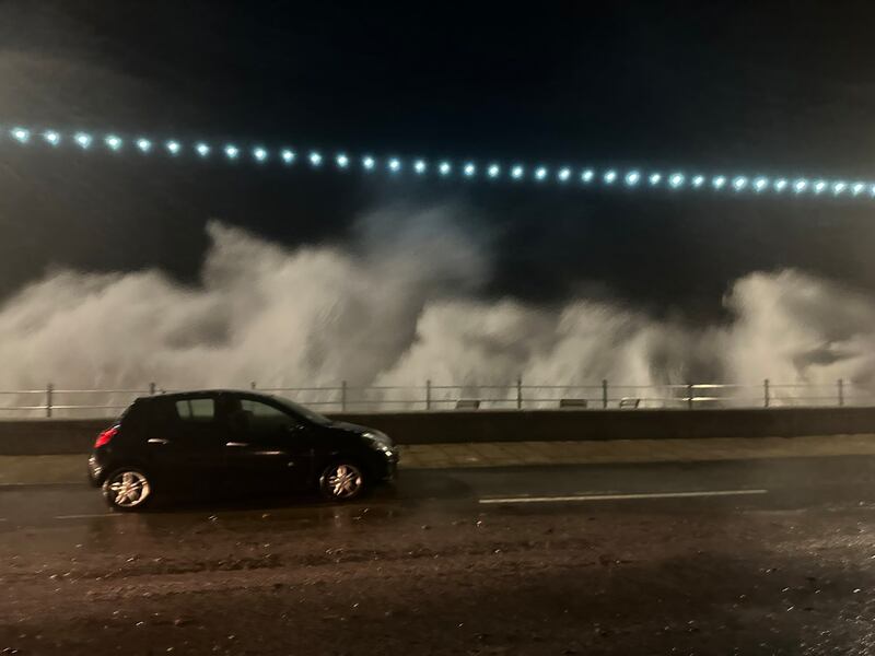
Storm Ciaran – in pictures

The national forecaster in Ireland, Met Eireann, also predicted heavy rain, strong winds and flooding in southern counties.
“It looks like a once-in-every-few-years storm for the UK and France,” said Bob Henson, a meteorologist and science writer with Yale Climate Connections, but could turn into “a once in a generation storm”, he said.
The blustery weather is the result of a branch of the jet stream – a consistent band of strong wind high above the Earth's surface heading west to east – heading towards northern Europe, Mr Henson said.
The band is arcing southward from its origin point high above eastern Canada, intensifying a low-pressure area and causing the storm, he said.
The storm is caused by an interaction between what is going on near the surface and a few kilometres above ground.
“You’ve got the ingredients near the surface – warm moist air, cold air to the north – and the jet stream takes those ingredients and creates a winter storm out of them,” he said in an interview.
It was also possible that the storm might see a “sting jet”, he said, when part of the jet stream descends to the Earth's surface very quickly, gaining momentum as it goes. This “punches” a small area of the surface with high winds, he said, causing serious damage.
If it does, it could be among the handful of strongest storms in the region for the last 200 years, he said.
“Be prepared for things to be flying around,” he said.
Friederike Otto of Imperial College London’s Grantham Institute for Climate Change and the Environment, studies the extent to which extreme weather events are caused by global warming.
She said there had been few studies on whether wind speeds were increasing because of climate change, and understanding is hampered by the fact that there were few observations of wind speeds taken far back in the past.
But the rainfall associated with such storms has increased due to human-induced climate change, she said, and that would mean damage is more severe.
That is because a warmer atmosphere can hold more moisture which must fall as rain.
On that, the science was “quite clear,” she said, with a 7 per cent increase in rainfall for each degree Celsius of global warming.
Rising sea levels due to global warming also lead to more damaging storm surges, she said.