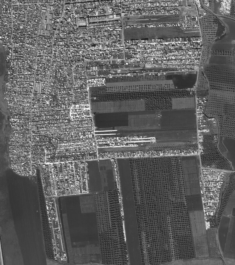
Satellite images are being used to expose the rapid growth of camps for internally displaced people in northwest Syria and the severity of the damage that has rendered their hometowns unlivable.
A new report from the Harvard Humanitarian Initiative, Save the Children and World Vision used satellite imagery to analyse two displacement camps in north Idlib, tracking the growth of the camps from 2017 to February 26, 2020.
Families that have been driven from their homes by relentless aerial bombardments are left with few available options. Desperate for safety, these families have been forced into both formal and informal camps in north Idlib.
The jarring imagery showed one camp nearly tripling in size over the past three years, growing 177 per cent. Another camp doubled in size, as displaced people sprawl out over what was previously agricultural land.
“Half a million children are crammed in camps and shelters at the border with Turkey with no access to the basics of a decent life: a warm place to sleep, clean water, nutritious food, and education. Families are being squeezed beyond breaking point,” said Sonia Khush, Syria country director for Save the Children.
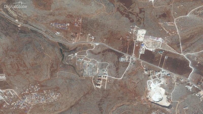
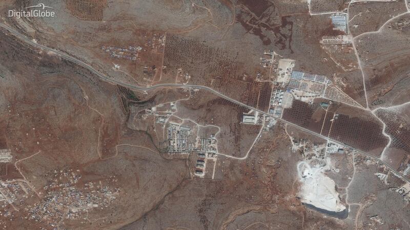
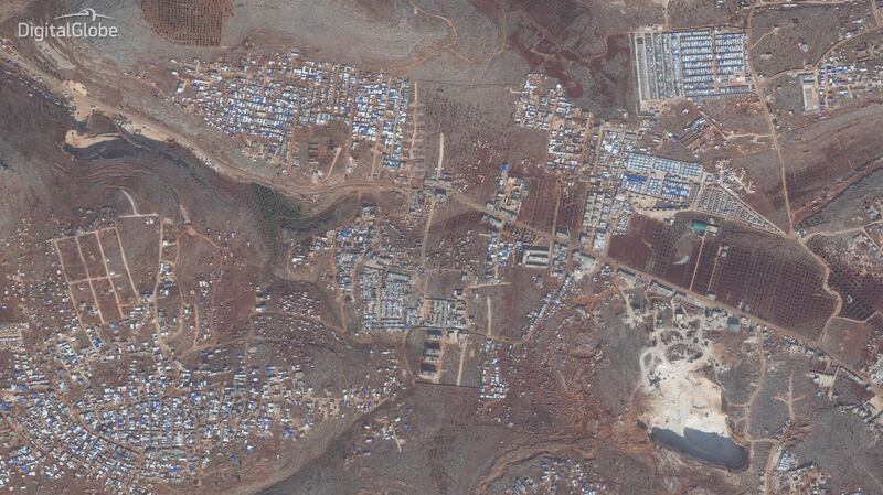
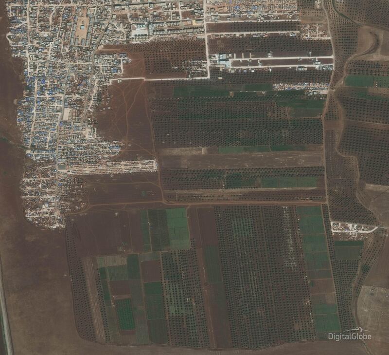
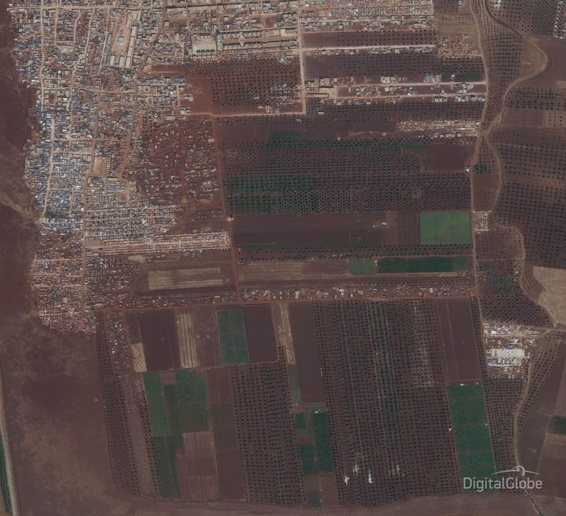
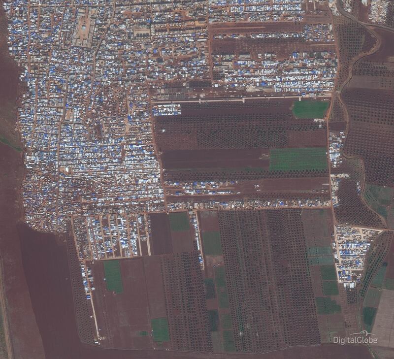
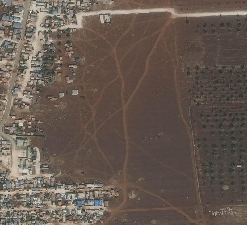
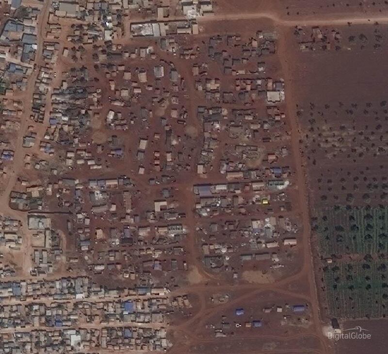
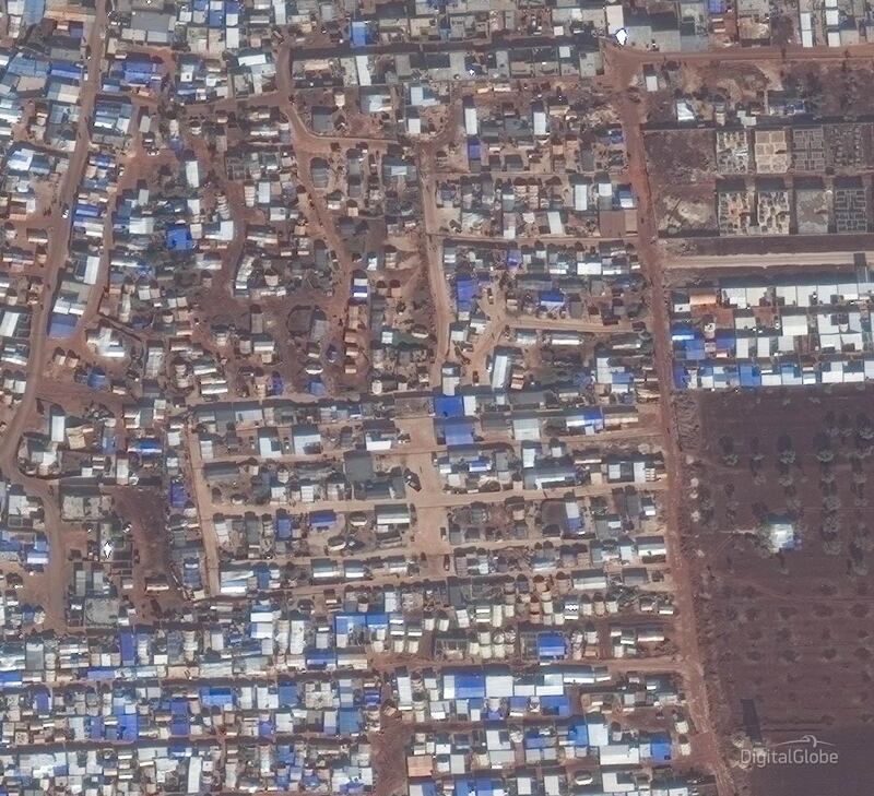
The report found that the camps' population density appeared to grow acutely for two years, with sharp increases that align with the military offensive launched in April 2019 by the forces of Syrian president Bashar Al Assad to take control of Idlib, the last remaining opposition-controlled territory in the country.
The offensive escalated sharply in December, forcing the displacement of nearly one million Syrian people, more than half of them children, and ballooning the size of the camps.
“Boys and girls aged five or six can name every type of bomb by its sound, but sometimes can barely write their name having missed out on the chance of an education,” said Johan Mooij, World Vision Syria response director. He said the only solution to the crisis is a lasting ceasefire.
The satellite imagery also examined two front line towns in southern Idlib and found that nearly one-third of the buildings were so severely damaged they were uninhabitable, leaving families with no viable option to return home. The displacement has hollowed out more than 45 per cent of Idlib province.
Fadi, 15, is one of many children living in the makeshift camps. After he lost his arm in an air strike his family decided to flee their village.
“The attacks were vicious. We couldn’t take anything with us except mattresses, blankets and some of our clothes," he said.
"When I lost my arm, I felt as if I were dead. Now, I carry bricks with my brother using one arm to help provide for my family.”
Nine-year-old Othman and his family also fled because of the deadly attacks on his home town. With nowhere to go, his family sought shelter in a mosque before being brought to the campsite.
“All my friends are gone, there’s no one left in my town. They’ve killed everyone there,” he said.
With journalists and humanitarian groups having limited access to conduct research within Syria, satellite imagery is a powerful tool that allows for an external analysis of the long term fallout resulting from the near constant fighting taking place inside Idlib.
But limitations still exist. Many families are not captured by satellite imagery because they do not live in the tents. Aid groups estimate that tens of thousands are living without a tarp or shelter available to them.