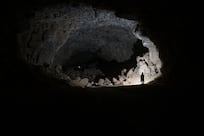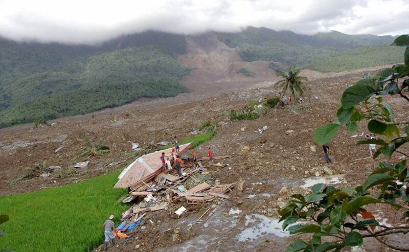
MANILA // On a windswept clearing just outside St Bernard on the southern tip of Leyte a solitary cross marks the spot where an entire village was obliterated by a massive landslide that killed up to 3,000 people. In a matter of minutes the once-prosperous farming village of Guinsaugon in central Philippines, nestled below a mountain and sitting among lush rice fields, was buried under an estimated 21 million cubic metres of mud and rock.
The disaster struck just after 10.30am on February 17, 2006, as 250 pupils filed into their classrooms at the local elementary school. Days of relentless rain had weakened the soil and rock along the mountain face behind the village to a point where it became so weak it gave way. It crushed everything in its path, including the village, the school and its inhabitants. Photographs of the landslide showed the full extent of the devastation - a sea of brown mud and rock fanning out across 323 hectares of green, fertile farmland.
No one knows exactly how many people died that morning: only 128 bodies were recovered, and about 500 people rescued. The provincial government placed the toll at 1,000 dead and missing. The village census however placed the number of residents at more than 3,000. The disaster prompted the president, Gloria Macapagal Arroyo, to order a complete geo-hazard mapping of the Philippine archipelago to pinpoint areas prone to natural disasters such as flooding and landslides. Volcano and earthquake prone areas were mapped earlier by the Philippine Institute of Volcanology and Seismology.
The World Bank said in a report published in 2004 that the Philippines, "by vairtue of its geographic circumstances, is prone to natural disasters - making it the most natural disaster prone country in the world". Since 2006 a small team of geologists and mining engineers from the Mines and Geosciences Bureau have fanned out across the entire length and breadth of this South East Asian country putting together the maps that, in theory, should save countless lives in the future.
"Mapping is the easy part," said Antonio Apostol, who is in charge of the bureau's Lands Geological Survey Division. "The hard part is trying to convince people living in danger areas to move and the political will to relocate people. Many local politicians see people as votes and don't like seeing them move to another constituency." So far more than 90 per cent of the archipelago has been mapped and the remaining 10 per cent is on course to be completed by the time Mrs Arroyo leaves office on June 30.
"Considering the scale of the operation it is a remarkable achievement," Mr Apostol said. The bureau began hazard mapping after the Cherry Hills housing estate was swept down a hillside in Antipolo, outside Manila, on August 13, 1999, killing 60 residents. "The subdivision should never have been built," said Edwin Domingo, an assistant director of the bureau. "Built on the side of a hill, no one had bothered to check the geology of the area to see if it was stable."
It was not until a series of typhoons slammed into the eastern seaboard of Luzon in 2004 and 2005, killing hundreds in flash floods and landslides, that the government started taking notice and asking: Why? "It's not as though no one knew of the dangers," Mr Apostol said. "Between 60 and 70 per cent of the country is prone to typhoon, flooding, landslides, volcanoes and earthquakes. The safest part of the country is the northern half of the western island of Palawan."
The bureau was established and given a yearly budget of five million pesos (Dh400,000). Until 2006. "It was the Guinsaugon disaster which saw a dramatic turn in the government's response. Our budget was increased from five to 60 million pesos by the president and we were able to assign 160 geologists and 70 mining engineers to the task of mapping the entire country." Mr Apostol said it was a popular misconception that deforestation was the cause of landslides. Over the past 100 years more than 90 per cent of the natural forest cover has been stripped away.
"The trouble is that the land is simply unstable, with or without trees. The media only covers those landslides in which people are killed, but our satellite photos show major landslides in areas [that are] uninhabited. Another factor is that there are major geological faults that run through the country. They are a dangerous combination." Mr Domingo said that once the project was completed "we will go back and do it all again".
"After five years barangays [villages] will have grown and roads built. We need to constantly monitor all these changes and what impact it is having on the area." foreign.desk@thenational.ae