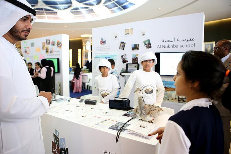
ABU DHABI // Schoolchildren have been using sophisticated electronic mapping to monitor falcon nests in Mongolia, track the migration patterns of the houbara bustard and assess conservation efforts at mangroves in Abu Dhabi.
The pilot programme is designed to integrate GIS, or geographic information systems, into the maths and science curriculums to boost pupils’ digital skills and promote inquiry-based learning.
The programme has been tested in 12 schools for a year, and will be extended to every Grade 6 pupil in the next academic year.
Project manager Ahmed Al Hammadi said such schemes were exciting for pupils, and without them it would be more difficult to make education enjoyable and attractive.
Maths pupils were challenged to analyse demographics data or measure their school using a surveyor’s trundle wheel. The science group took part in one of three assignments: studying the Abu Dhabi mangroves by measuring evidence of their revitalisation, tracking the migration of the houbara or monitoring 5,000 artificial Saker falcon nests scattered throughout Mongolia.
“We’re not teaching them only the software, we’re teaching them how to use this software to deliver, for example, mathematics learning outcomes or science learning outcomes,” Mr Al Hammadi said.
“It’s not about the tool by itself, it’s about learning to use this tool,” Mr Al Hammadi said.
Science adviser Parama Naidoo said the mangrove project had given the children hands-on experience.
“We selected about 43 boys and brought them over to the mangroves in Abu Dhabi where they did a physical study of the mangroves on site,” said Mr Naidoo, who worked with pupils at Al Tamayoz School in Al Ain.
“They had to do a quadrant study and count the number of plants and animals living in that particular quadrant. The data will be recorded annually by the students and it will be kept in a database so kids can have access to it … because we are looking at the impact of human activities on the destruction of these mangroves.”
Dr Amal Al Qubaisi, director general of Abu Dhabi Education Council, said the project was “one of the most important initiatives in education by Adec and the first of its kind in the Arab region”.
“Electronic maps are increasingly used in advanced countries to analyse huge databases,” Dr Al Qubaisi said. “They enable researchers and analysts to identify correlations between data, and thus help them generate more reasonable solutions.”
The programme is managed in partnership with the Abu Dhabi Systems and Information Centre, a committee established to modernise government services using information technology.
It is also supported by the Environmental Systems Research Institute in California, a supplier of geomapping and analytics software, which has allowed Adec to use its proprietary electronic mapping software, ArcGIS, at no charge.
rpennington@thenational.ae