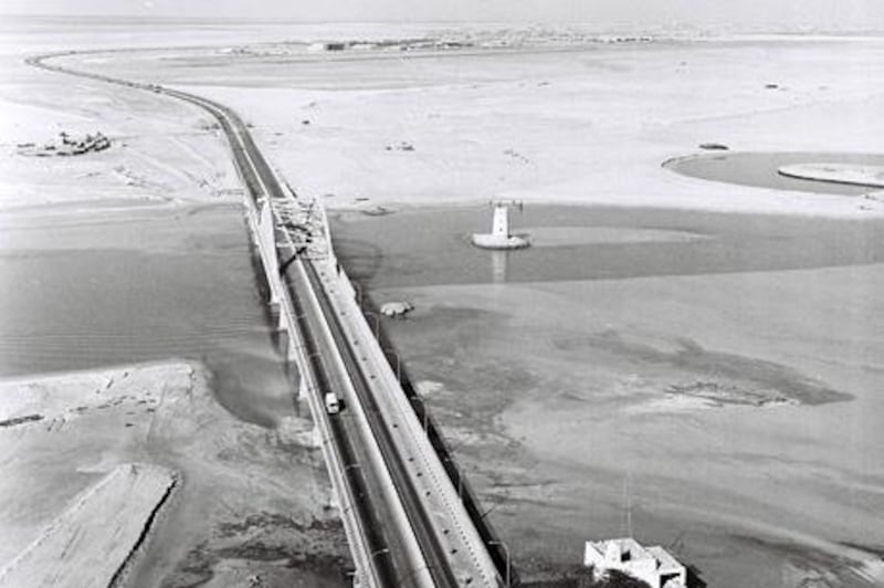
What is missing from this picture, taken shortly after the first span of the Maqta Bridge was opened in 1967?
The answer is almost everything, from the perspective of Abu Dhabi city as we know it today.
To the left of the photo is the site of the Fairmont and Shangri-La hotels. On the other side of the water, where the road curves right, are the gardens that surround the Sheikh Zayed Grand Mosque. The city itself is barely visible across the desert haze.
All the same, the landmarks in this image have shown remarkable resilience to urban sprawl. In the foreground is the building known as the Maqta Fort, which once served as the customs post for the city and now houses a small museum. The watchtower guarding the waterway is another remarkable survivor.
In the middle distance it is just possible to see the runway and main hangar at what was then the city's international airport, with the main terminal and a number of passenger aircraft to the right. The airport remains in use by the military, but is flanked by Sheikh Khalifa Park and Zayed Sport City.
* The National
Time Frame is a series that opens a window into the nation's past. Each week it features an image from the archives of both prominent institutions and private collections. Readers are invited to make contributions to yourpics@thenational.ae