DUBAI // The emirate's population increased 5 per cent last year to 2.1 million, according to estimates from the Dubai Statistics Centre.
Men make up more than three quarters of the population, similar to estimates from previous years.
The gender imbalance is generally attributed to the number of male expatriate workers who come to Dubai without their families.
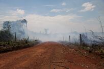
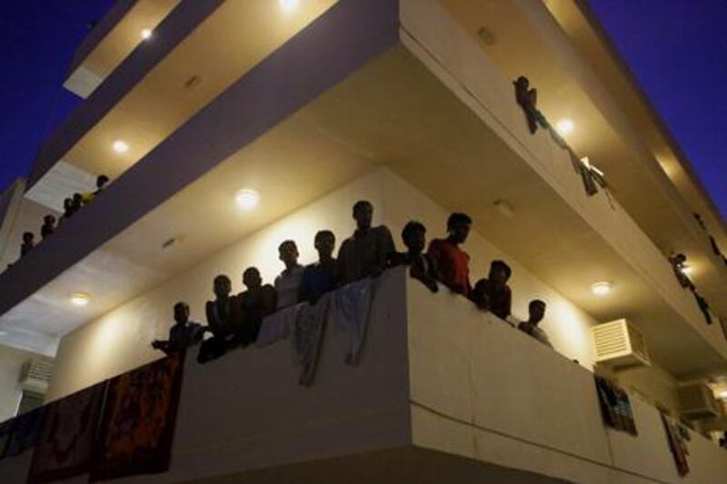
The most populous neighbourhood in the emirate was Muhaisnah 2, a labour camp area known as Sonapur, where there are more than 3,000 men for each woman. Muhaisnah 2 contains about 8 per cent of Dubai's population in 5.5 square kilometres.
The statistics centre also provided an estimate of daily visitors to Dubai - people who travel for work, leisure or tourism but live elsewhere.
It was estimated that there were 1,041,705 daily visitors last year, up 2 per cent from the previous year.
Dubai has not undergone a full census since 2005, but each year the centre releases population estimates that extrapolate on data from previous years. It analyses immigration, deaths, births and yearly labour force surveys to form its estimates, said Juma Al Hosani, director of population and social statistics at the centre.
The 5 per cent increase in population between 2011 and last year is typical, Mr Al Hosani said.
"We have a growth rate of 5 per cent yearly," he said. "We used to have 7 per cent but after the economic crisis we reduced to a 5 per cent growth rate."
Mr Al Hosani said that the margin of error for any population figure the agency released was generally less than 5 per cent. The centre's annual estimates include data on more than 200 neighbourhoods in Dubai, their boundaries demarcated by Dubai Municipality.
View Larger Map
This year, the centre also released an elaborate online map that illustrates the estimates using spatial data known as geographic information systems, or GIS.
"How many people know the shape of Dubai?" asked Muna Al Zarooni, an eservices system analyst at the centre. "It looks like a Mickey Mouse, I love it ... we want to spread the knowledge of geospatial thinking, especially in our country.
"The map is one of the tools that we use to make it understandable for the public," she added.
The map can be found online or shared with friends on Facebook or Twitter. People can also use it to measure area or show population and gender ratios in any neighbourhood. "When you present something on a picture or map, it's easier to grasp the idea," said Huda Al Hammadi, head of the centre's eservices unit.
The three most populous neighbourhoods last year were all industrial areas or labour accommodations. Altogether, they made up 17.5 per cent of the emirate's population and were more than 99 per cent male, according to data from the centre.
But Dubai also contains 29 communities that are majority female, including parts of Al Barsha, Al Warqa, Oud Al Muteena and Al Twar.
One community - Za'abeel 2, where Za'abeel Palace is located - is perfectly gender-balanced, with 1,476 men and 1,476 women.
The centre conducts regular field surveys to strengthen its neighbourhood data, Mr Al Hosani said.
"Sometimes you might see in a year locals moving to another new area and this area is dominated by labourers, et cetera," Mr Al Hosani said. "We keep monitoring them and we do regular surveys to go into the field and check the correct data."
Staff at the centre have been trying out the map as a new feature during the past year. "It's becoming a global interest, geospatial thinking," Ms Al Zarooni said.
They plan to use the map to illustrate other concepts. "We'd like to change over time," she said. "We don't want to keep displaying the same thing."